
The Landscape Master Plan for Keningau District 2035
In an era of rapid urbanisation, the challenge for many regions is not just to develop, but to develop with a soul. The Keningau District is rising to this challenge with a forward-thinking and deeply analytical Landscape Master Plan (PIL MDK), a comprehensive framework designed to guide its growth while safeguarding the very essence of its character.
This isn't merely a plan for parks and gardens; it is a strategic blueprint for sustainable development, rooted in a meticulous study of the district’s unique physical, natural, and sociocultural DNA.
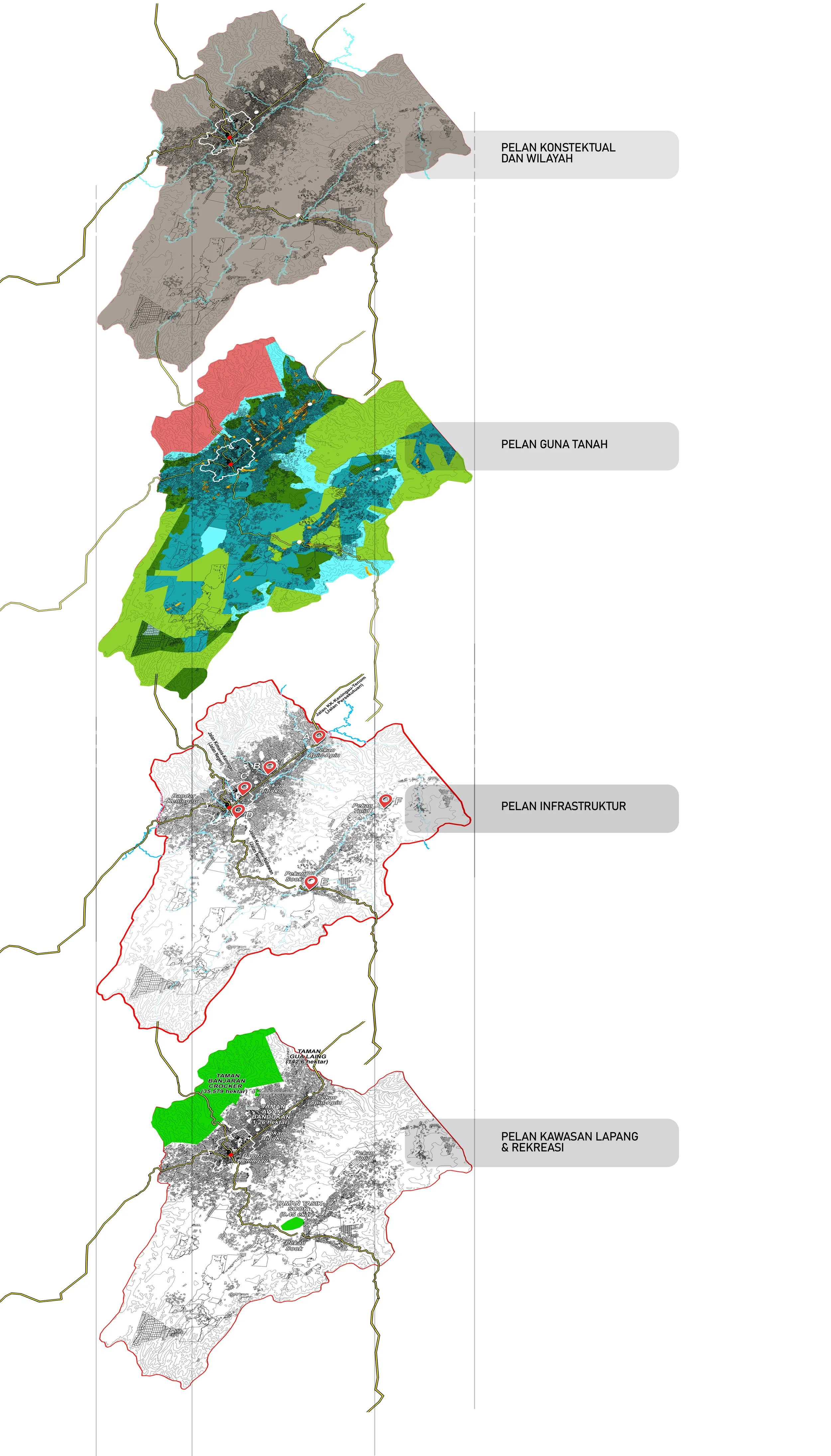
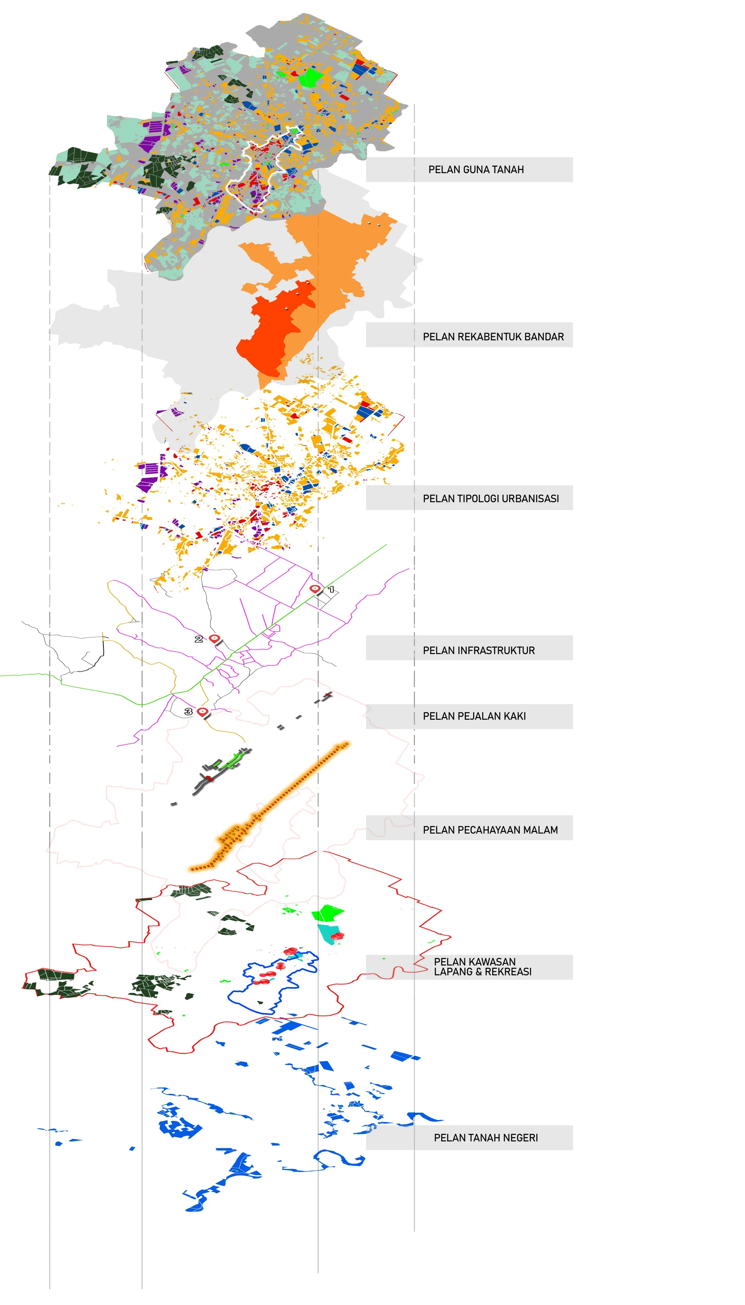
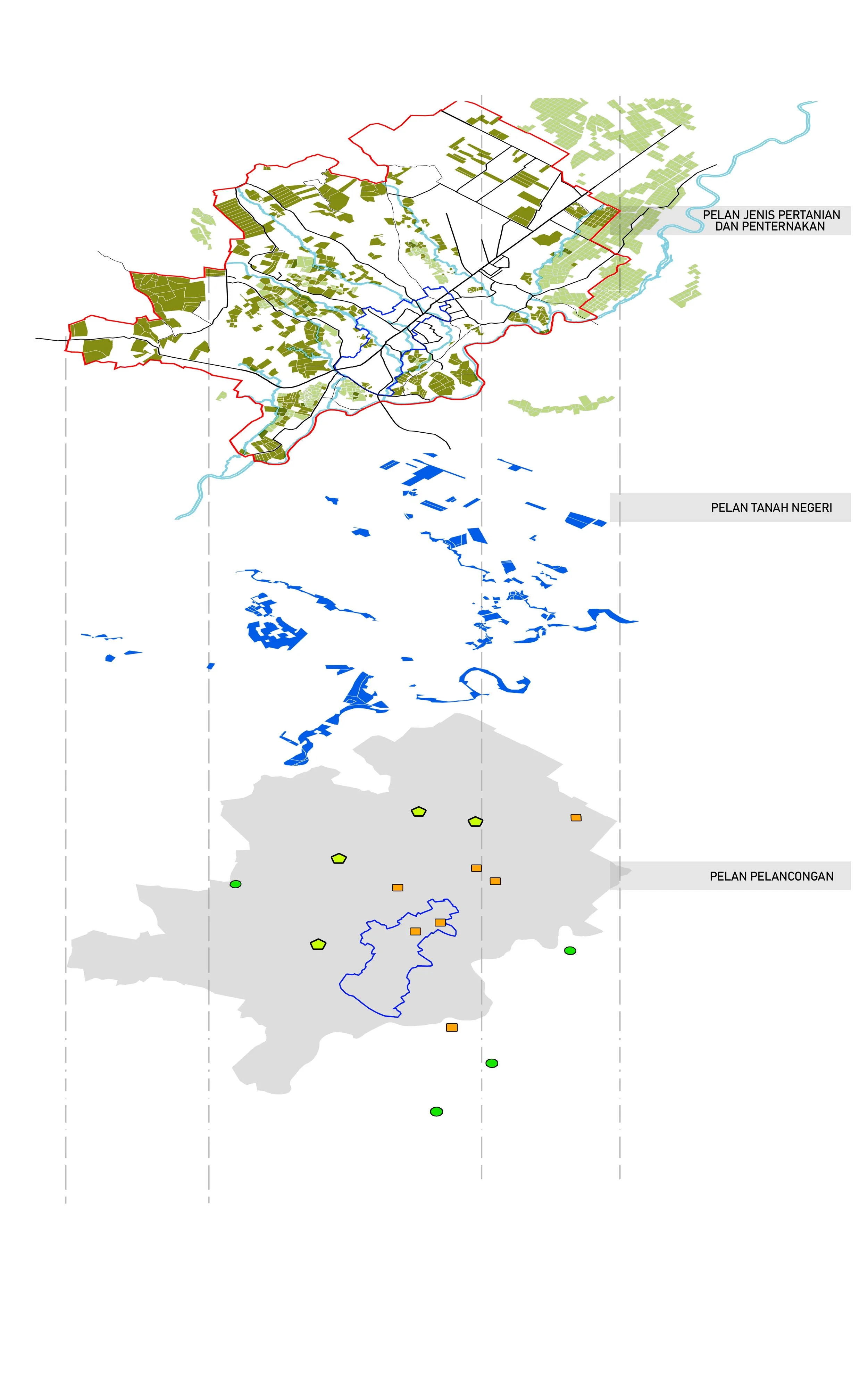
The formation of landscape parameter classification for the Landscape Master Plan of the Keningau District Council (PIL MDK) represents a comprehensive approach to understanding the district’s unique visual, ecological, and sociocultural identity. This classification system is grounded in two fundamental components: Landscape Character Areas (LCA) and Landscape Character Types (LCT).
LCAs are defined as geographical zones with distinct identities shaped by the combination of multiple landscape types, while LCTs are derived through detailed mapping and layering techniques that interpret physical, natural, cultural, and land-use patterns. Together, they form the conceptual backbone for the Keningau District Landscape Concept Plan and guide the policy direction for future development.
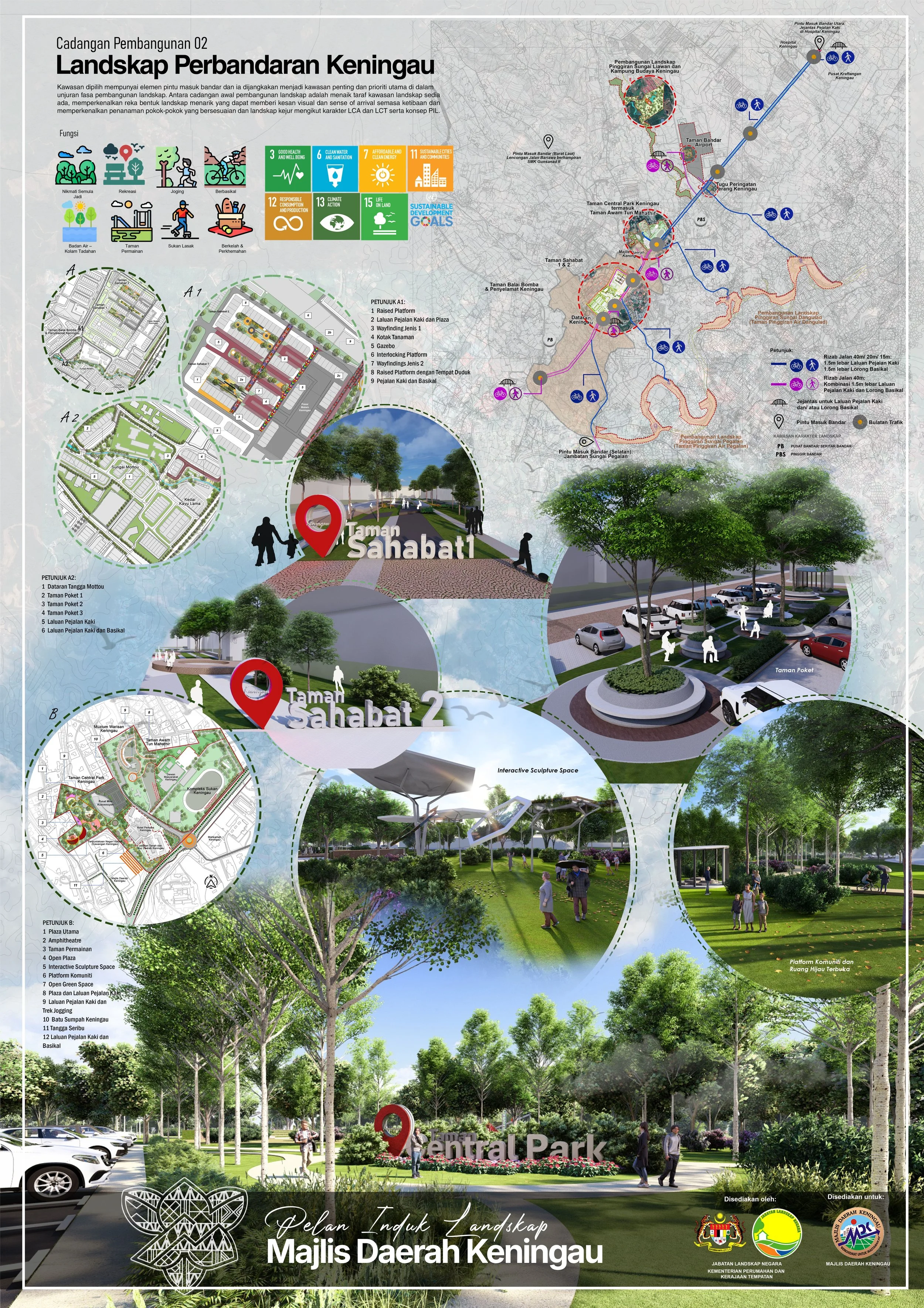
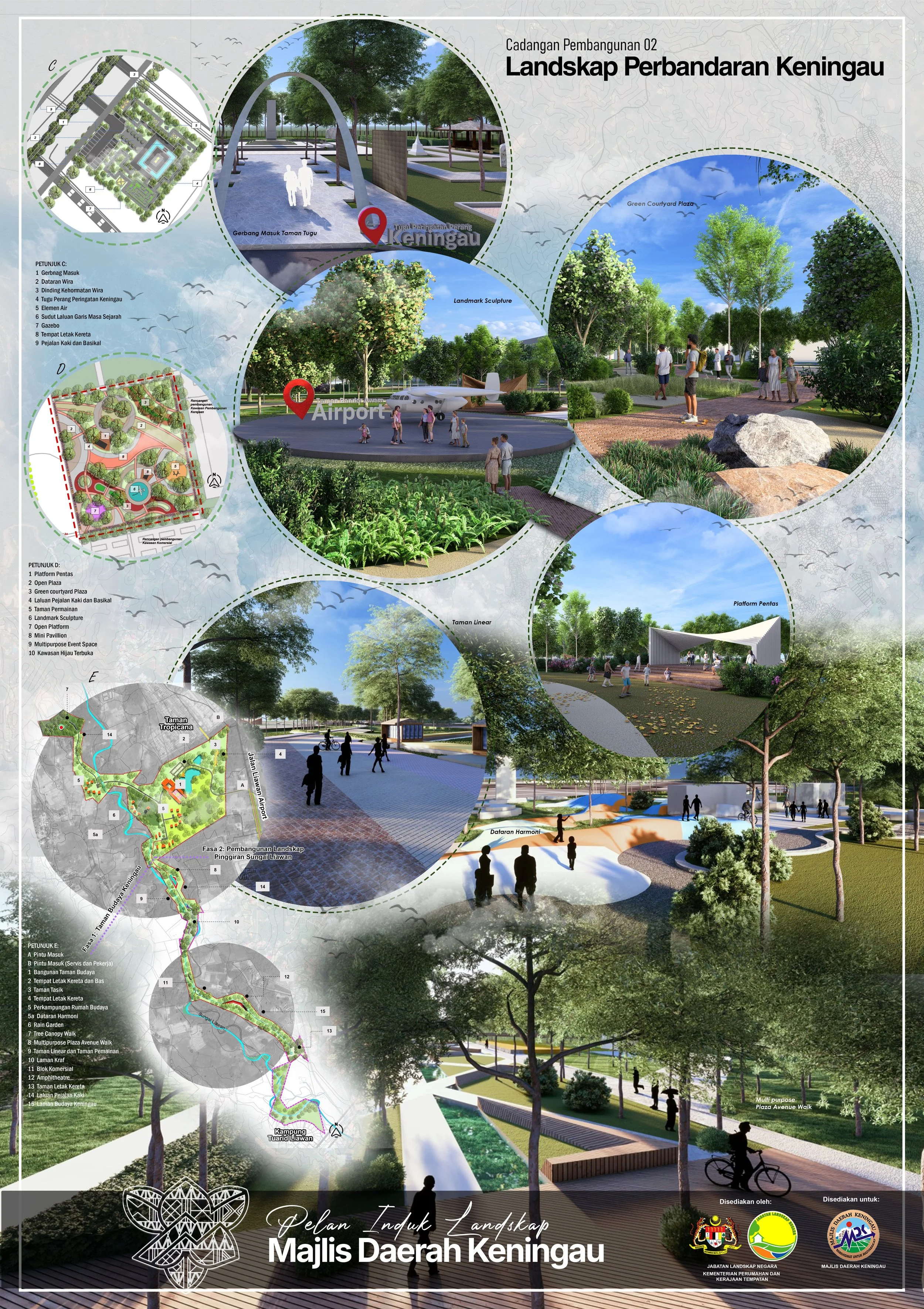
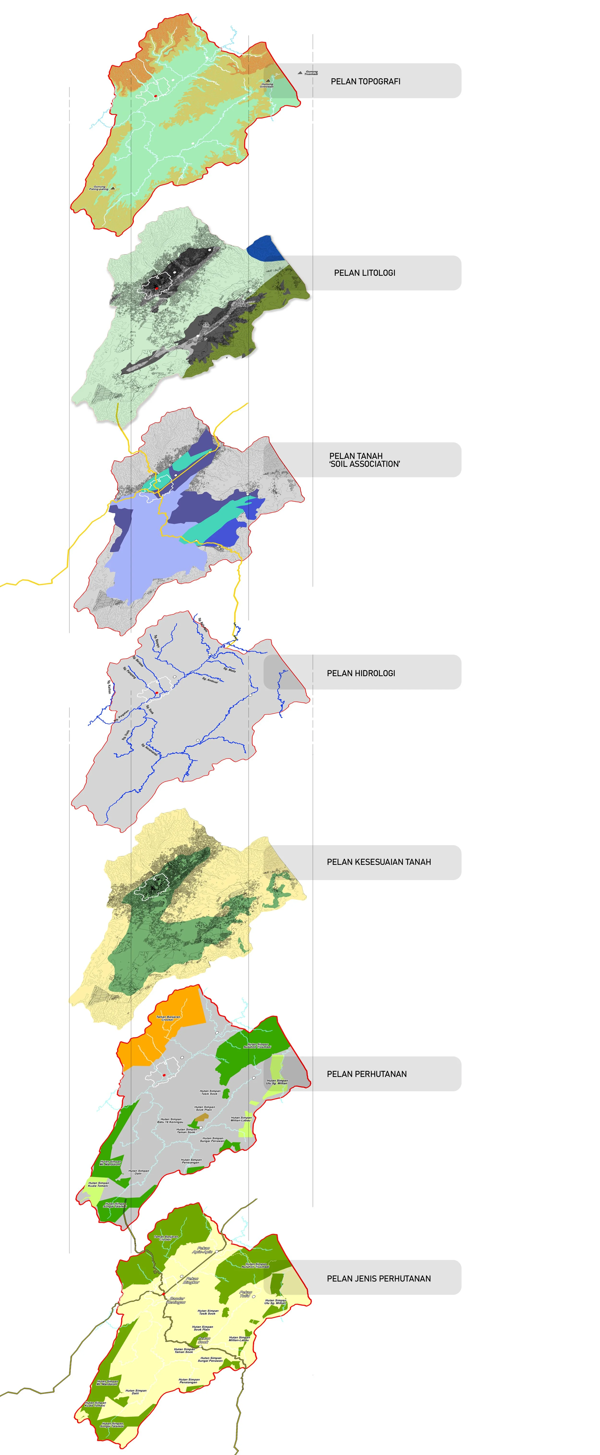
The assessment examines three key factor groups—physical, natural, and sociocultural. Physical factors such as land use, urban design, infrastructure, open spaces, and visual character reveal the district’s development structure. Natural elements including geology, hydrology, topography, soils, forestry, and climate define the ecological framework of Keningau. Sociocultural aspects consider demography, ethnic distribution, agriculture, tourism, and the local economy. Together, these analyses inform the Synthesis Integration Plan, identifying eight character areas ranging from the rapidly developing Central Business District to the untouched highlands above 500 metres.
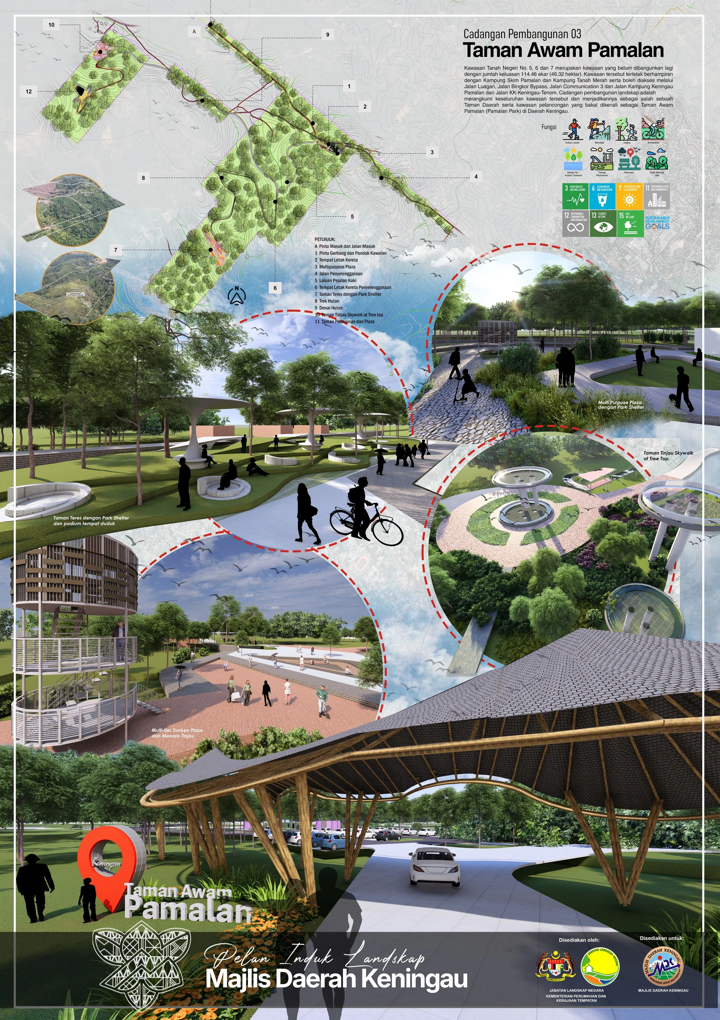
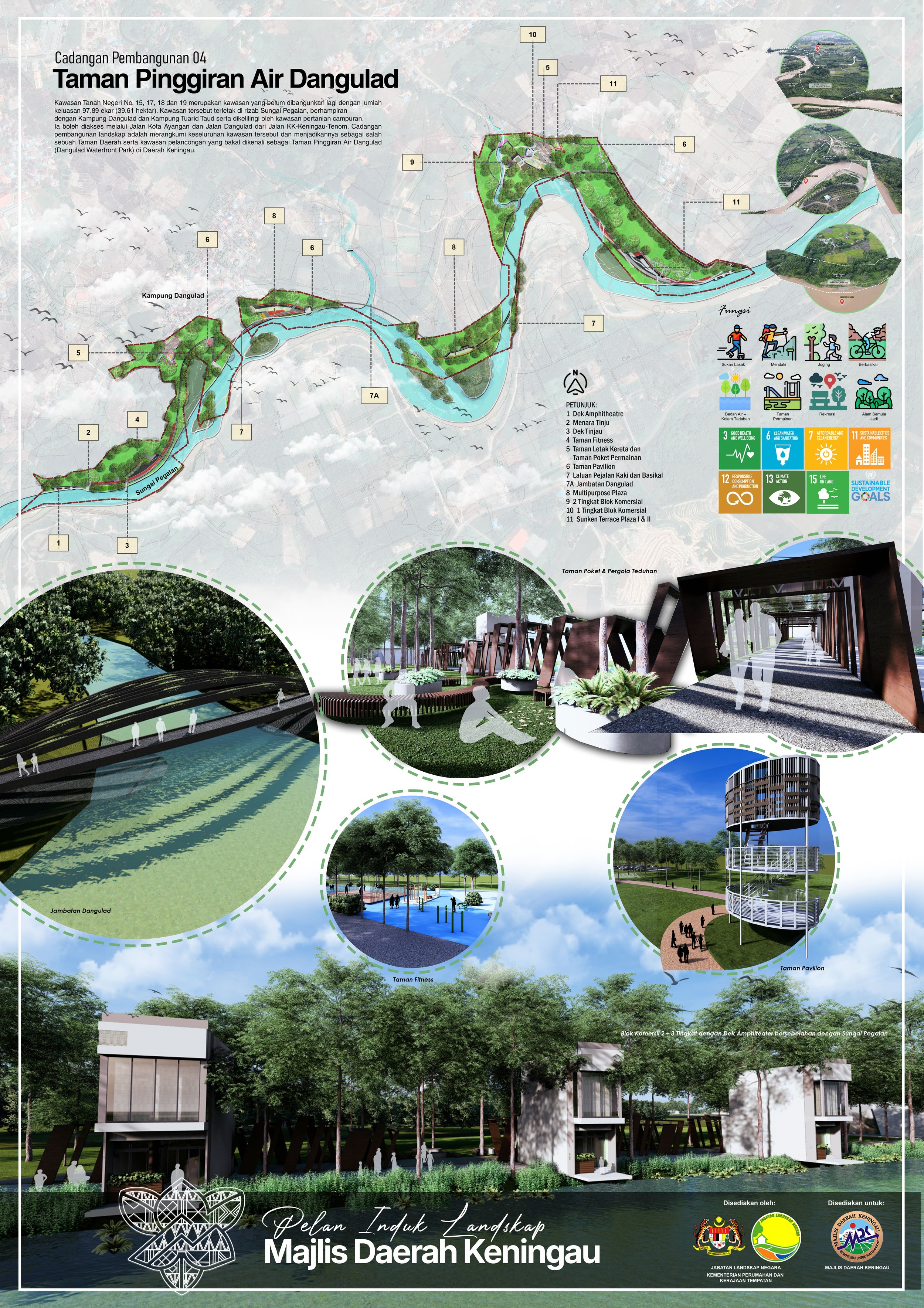
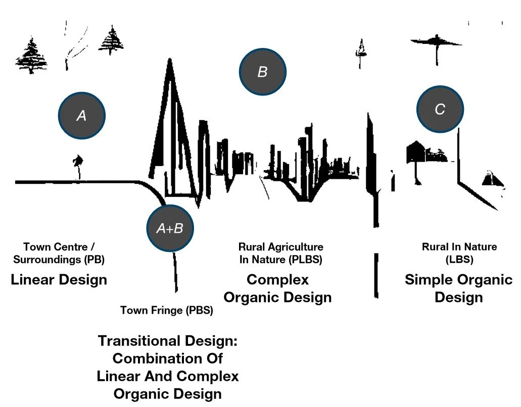
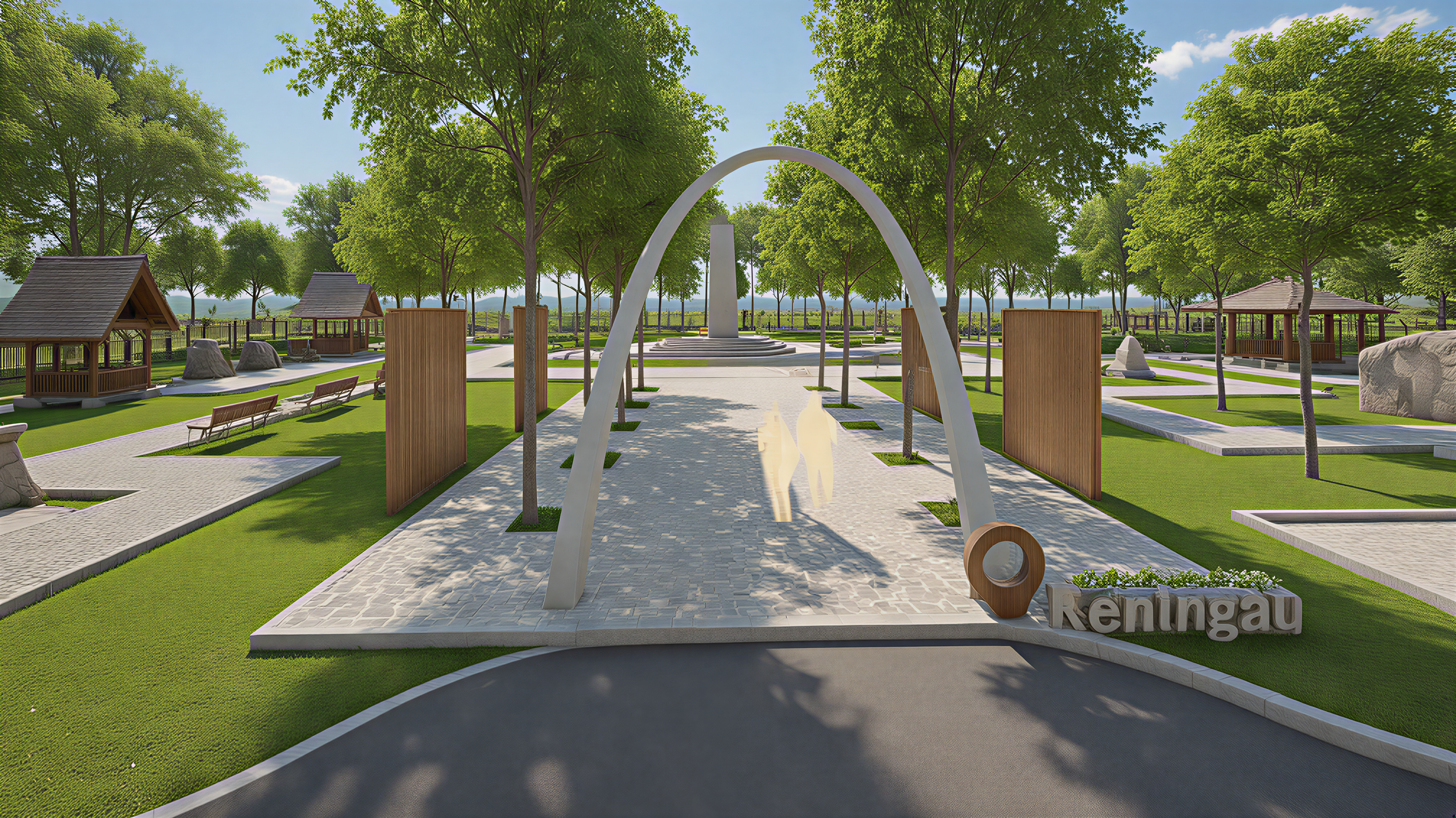
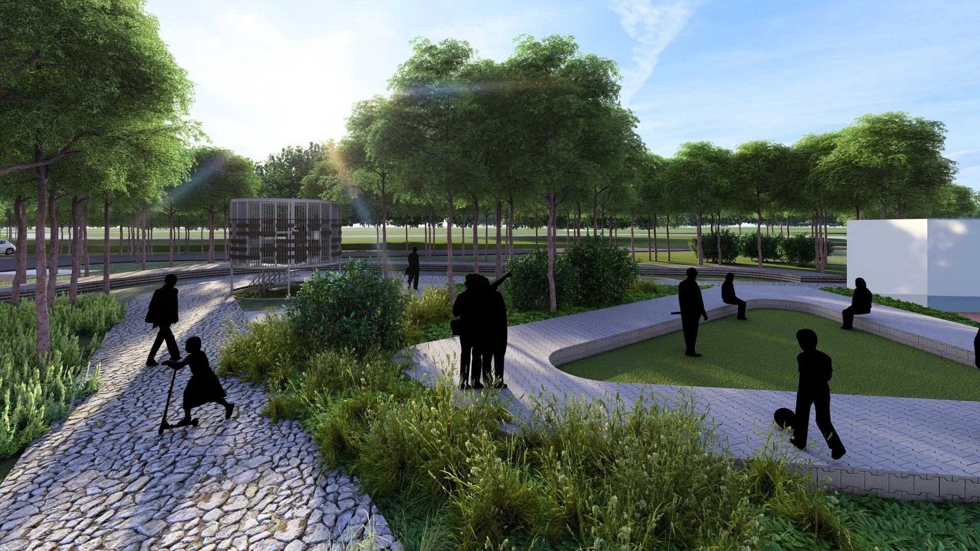
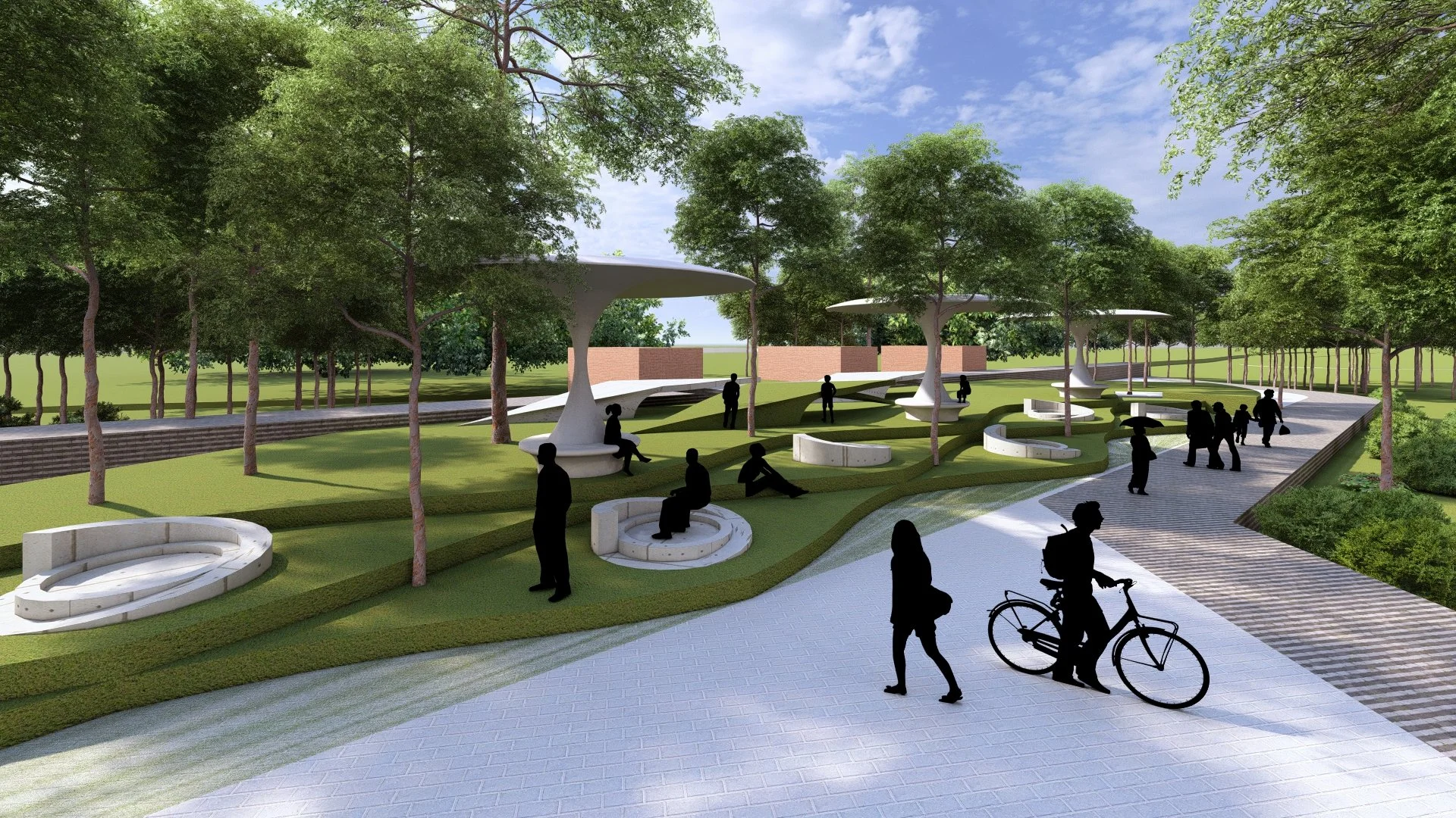
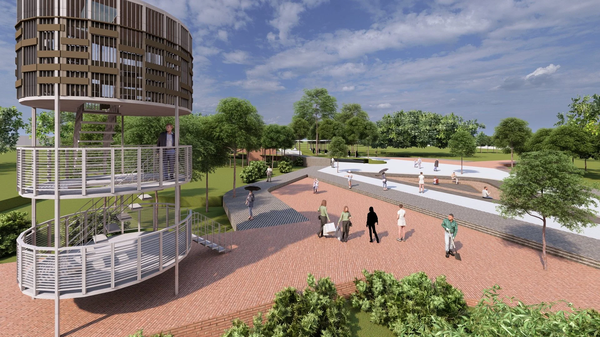
These eight character groups are further streamlined into four major LCAs—Town Centre/Surroundings (PB), Town Fringe (PBS), Rural Agriculture in Nature (PLBS), and Rural in Nature (LBS). Each LCA is associated with specific LCTs, landscape components, and potential development locations, ensuring that planning decisions enhance cultural heritage, local identity, and natural assets. The approach integrates both hardscape and softscape concepts, emphasizing pathways, nodes, gateways, forest profiles, and vegetation compositions suited to urban and rural contexts.
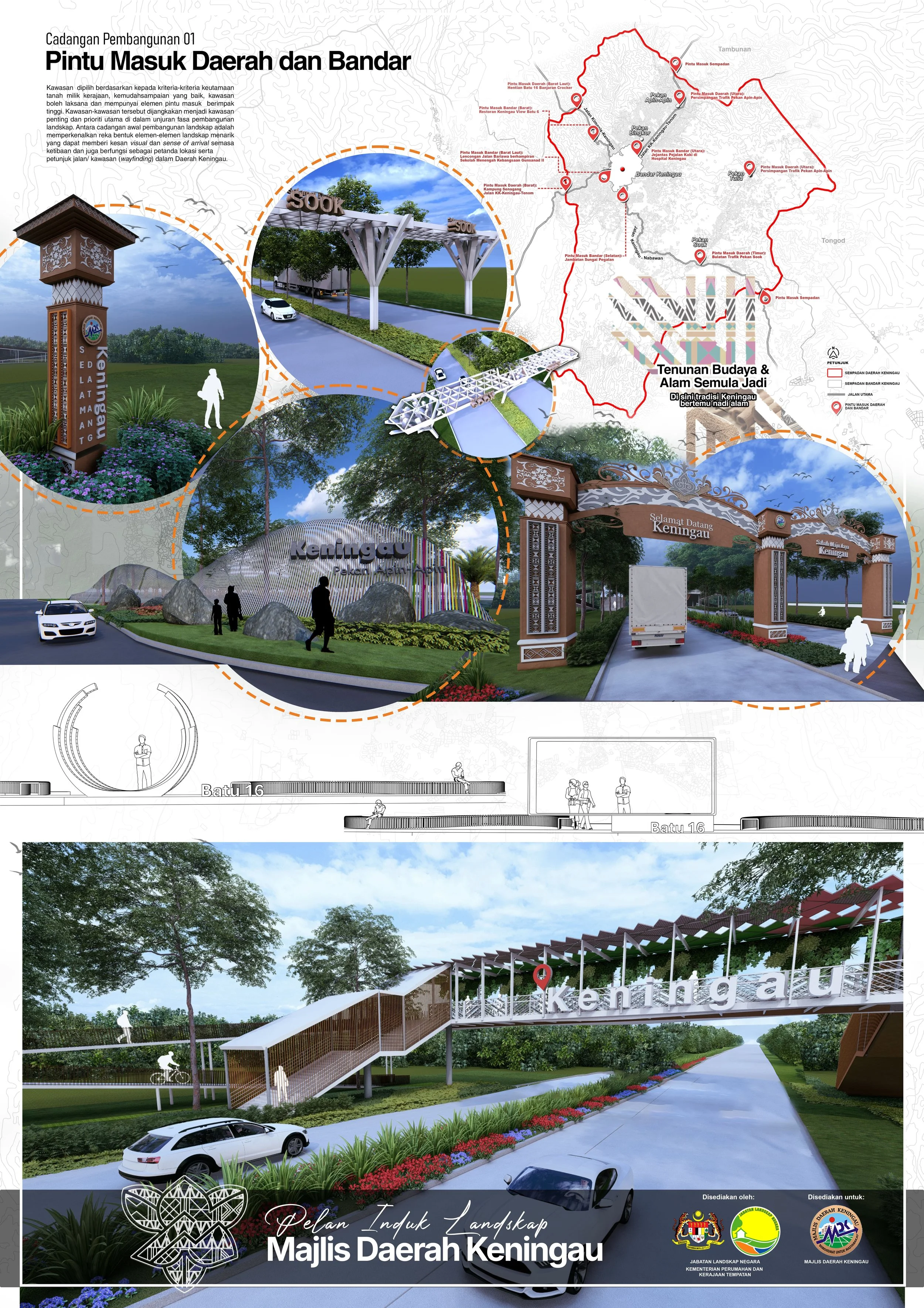
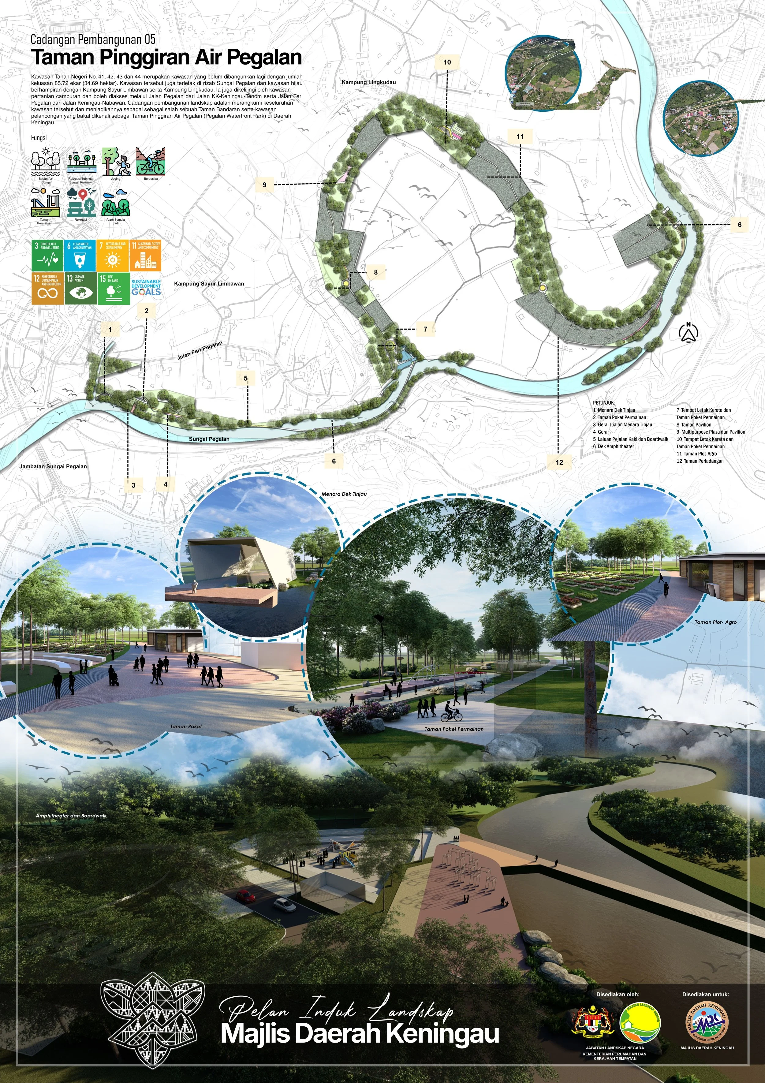
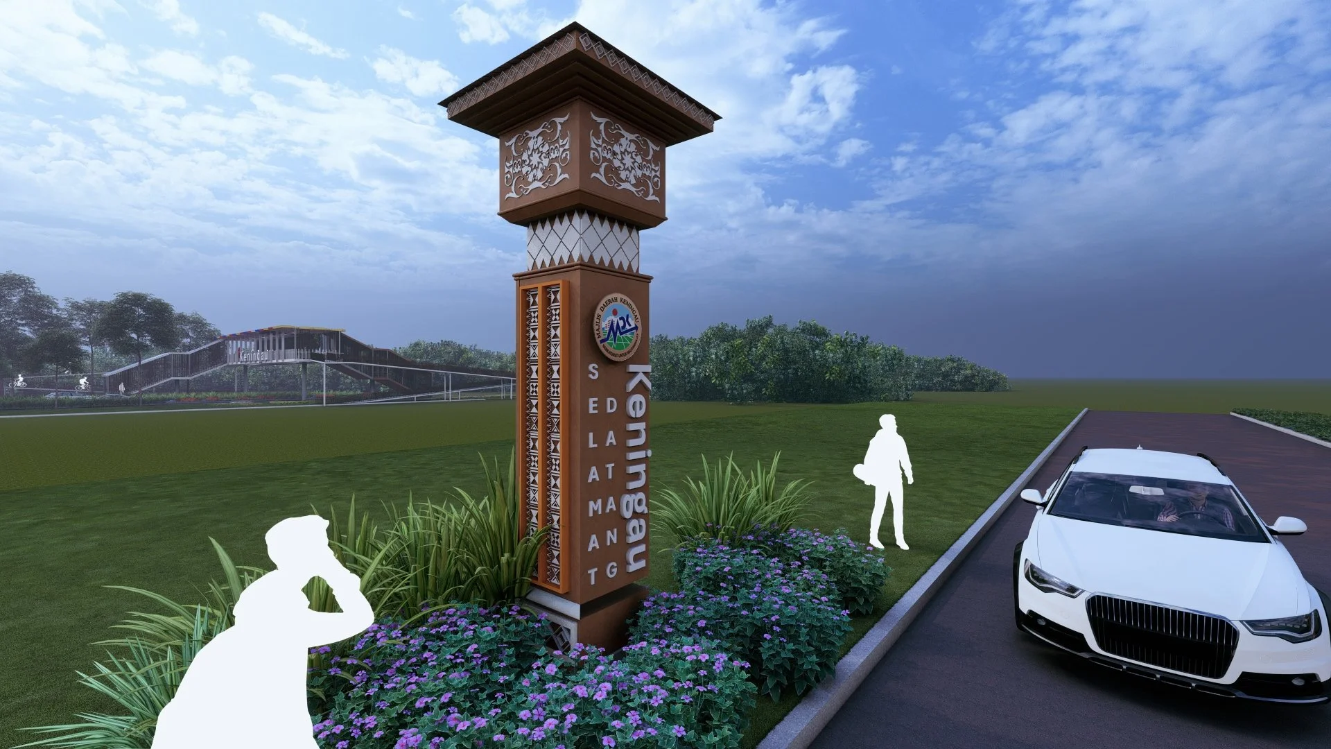
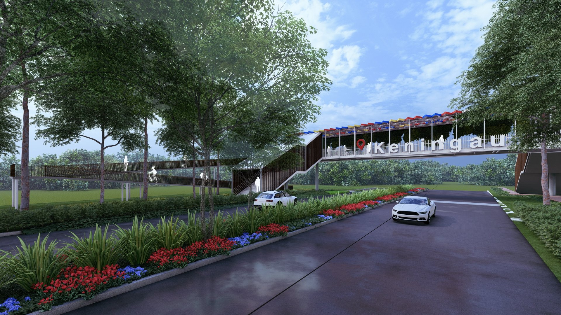
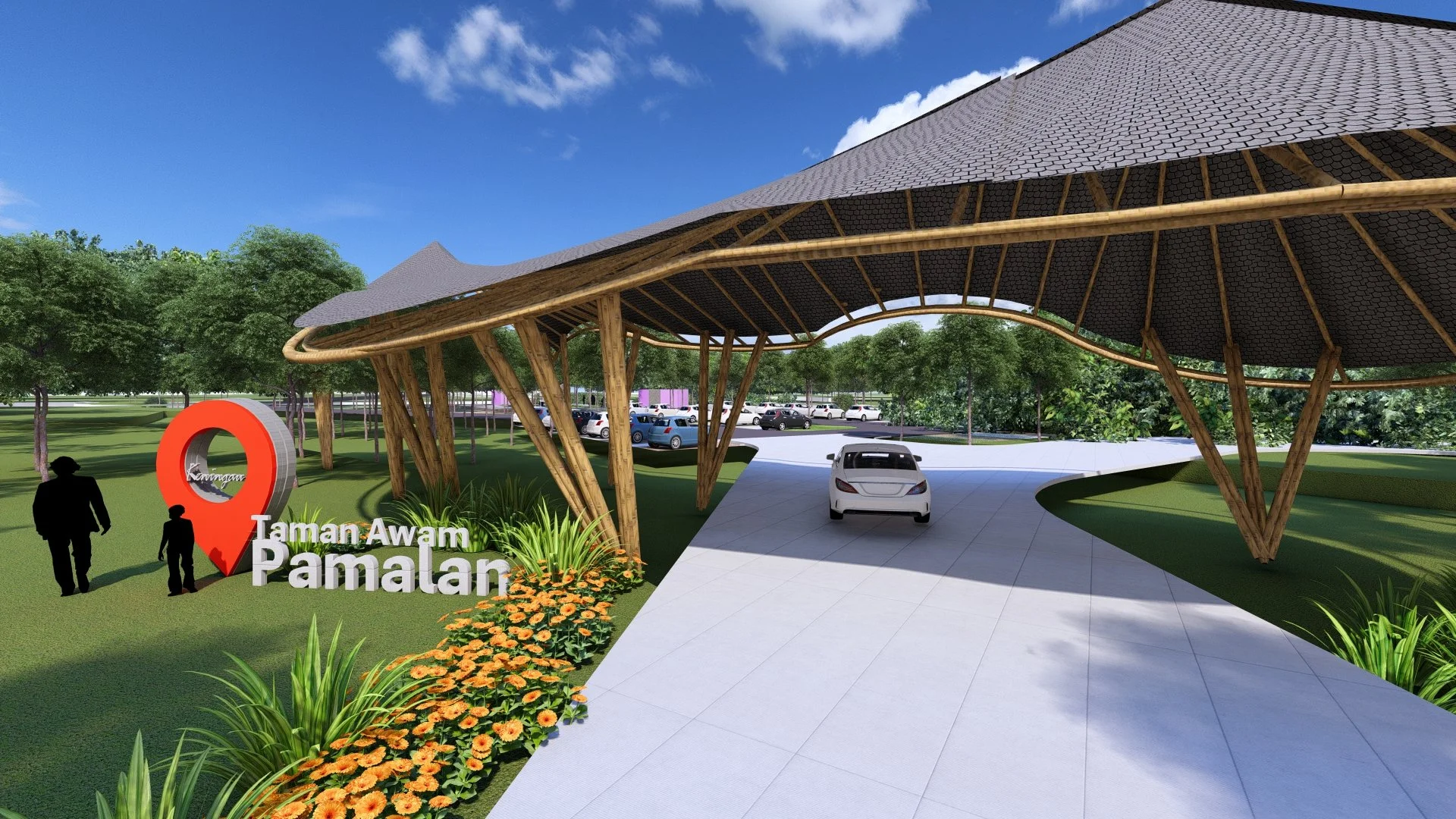
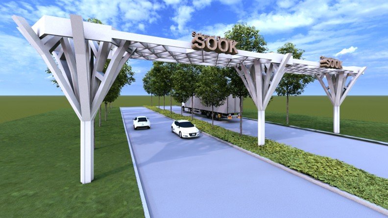
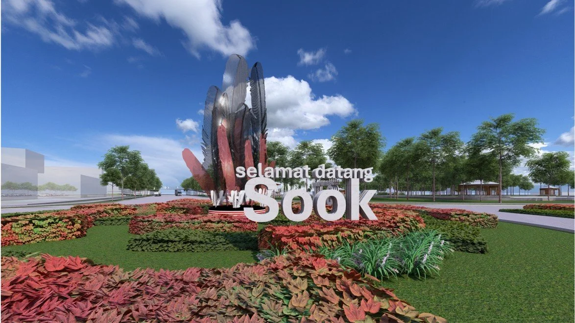
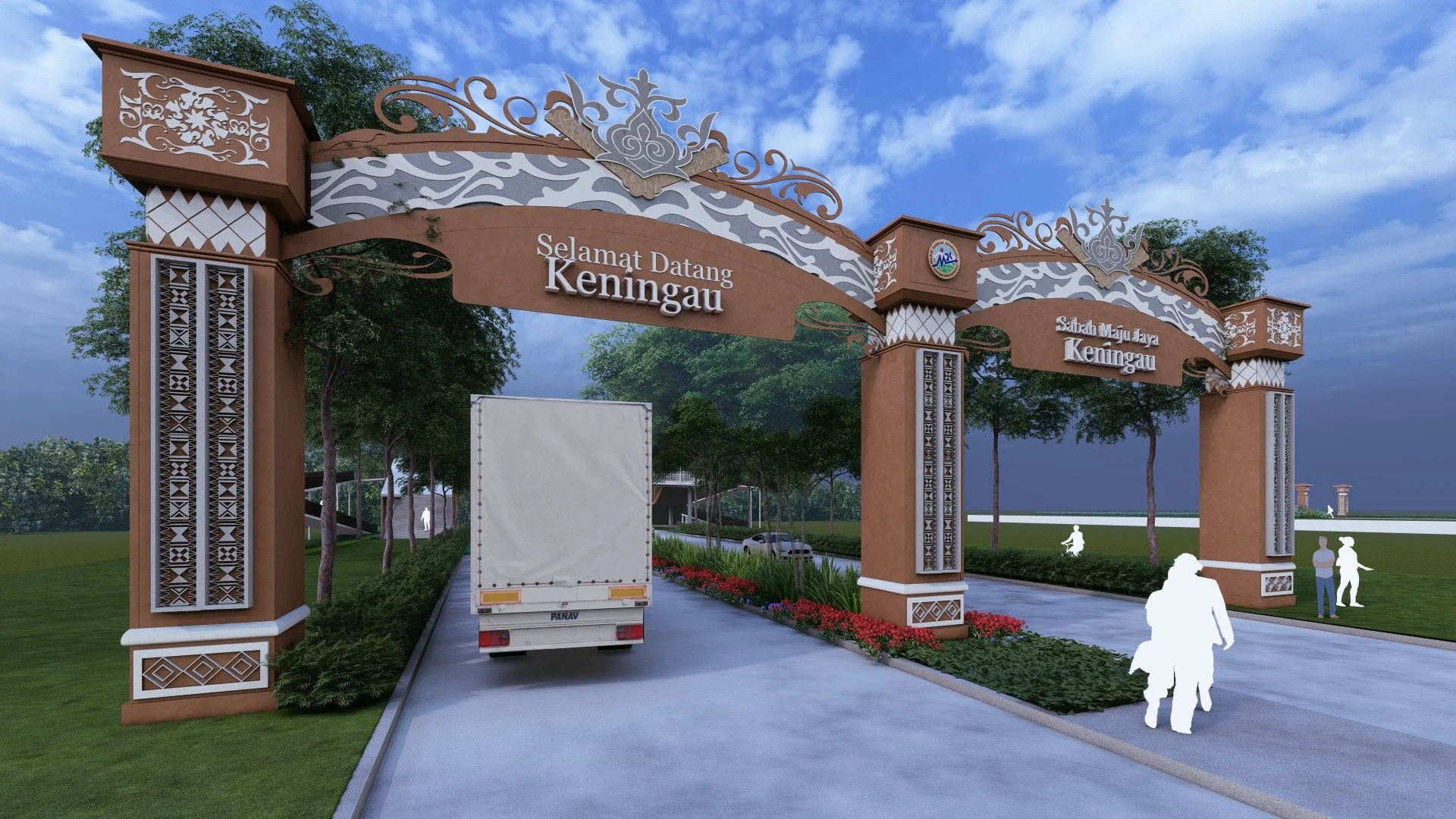
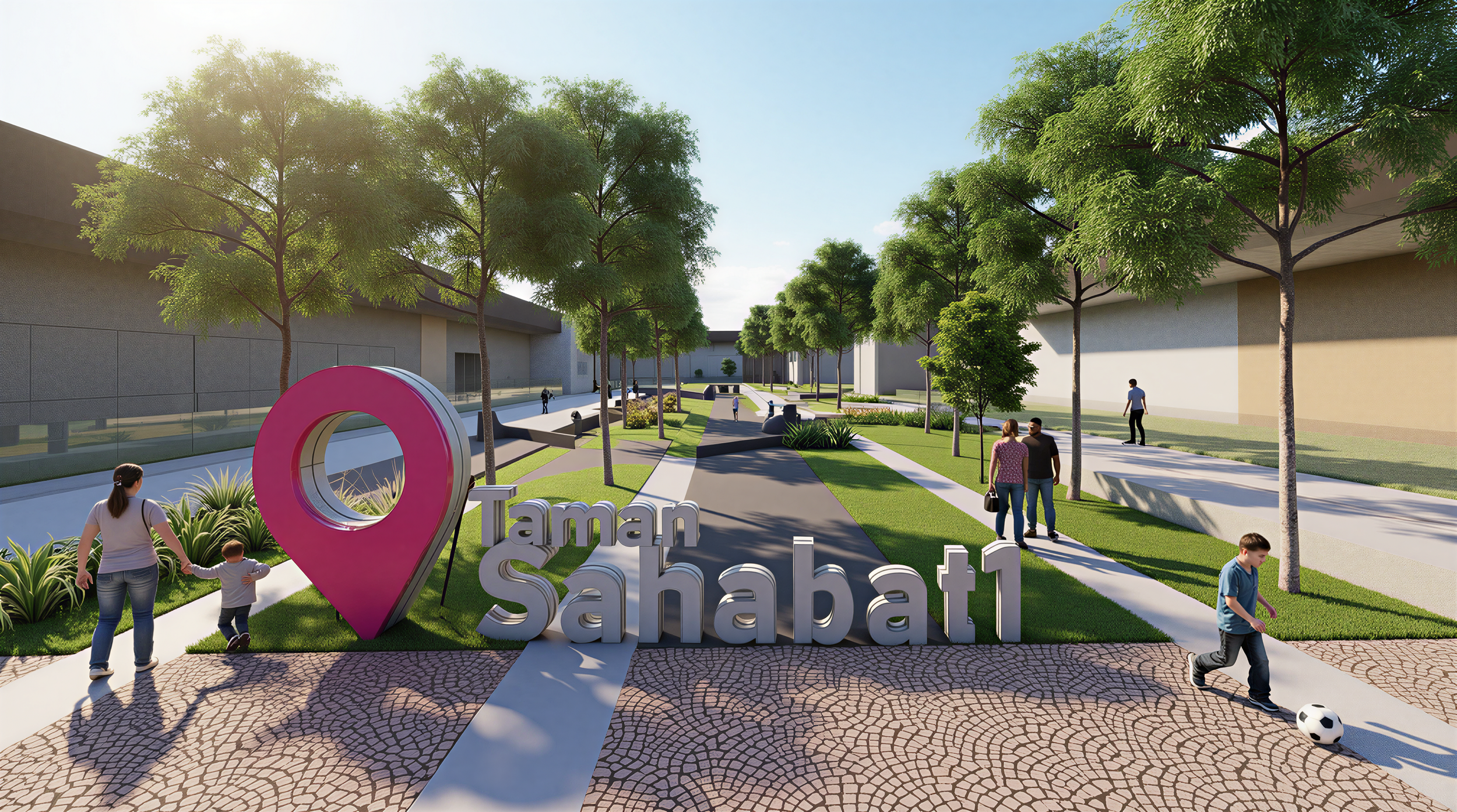
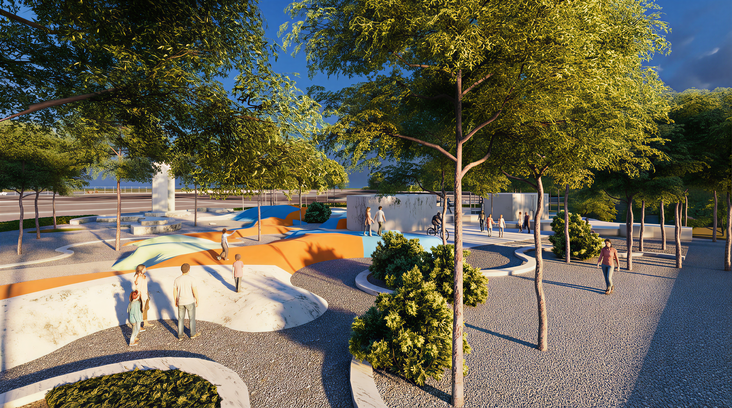
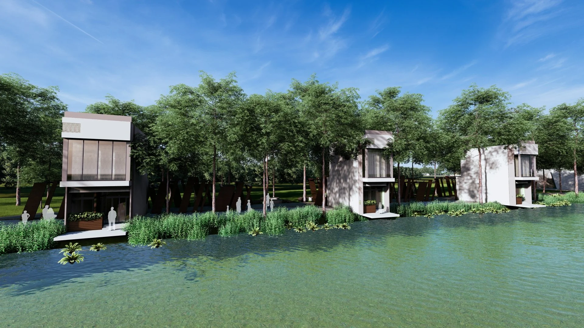
This visionary planning is backed by a concrete and actionable strategy. Six key Action Plan Areas have been pinpointed for development, including gateway enhancements, urban landscape upgrades in Keningau and Sook towns, and the vital development of riverfronts along Sungai Pegalan and Dangulad. The implementation is strategically phased over a decade, beginning with "Quickwin" projects for immediate impact and progressing to high-impact "Entry Point Projects" that will become iconic destinations. This staged approach ensures manageable budgeting and sustained momentum.
To ensure the plan’s longevity, the PIL MDK proposes the establishment of a dedicated Landscape Management Division within the Keningau District Council. This division, comprising units for Planning, Implementation, Maintenance, Nursery, and Administration, will be the guardian of the district’s landscape vision, ensuring that designs are approved to standard, projects are properly executed, and green spaces are maintained to the highest quality.
In conclusion, the PIL MDK is far more than a technical document. It is a promise for the future—a commitment to the vision of "Keningau 2035: Tourism City of Nature and Culture." By strategically balancing development with preservation, this master plan aims to fuel local economic growth, enhance community well-being, and firmly establish Keningau’s unique identity on the map, ensuring it grows not just as a district, but as a legacy.
Text by the architect
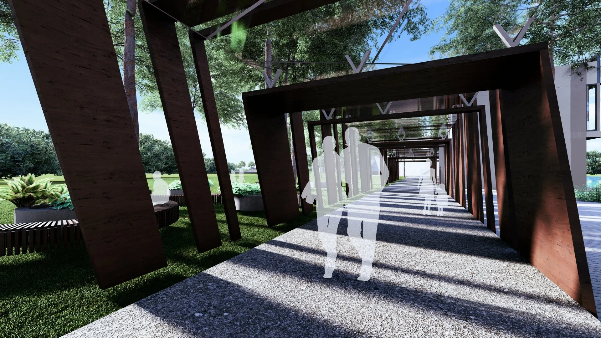
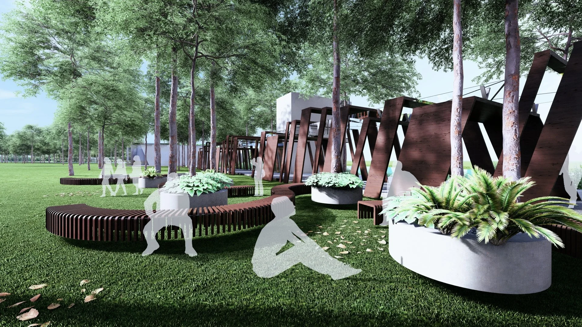
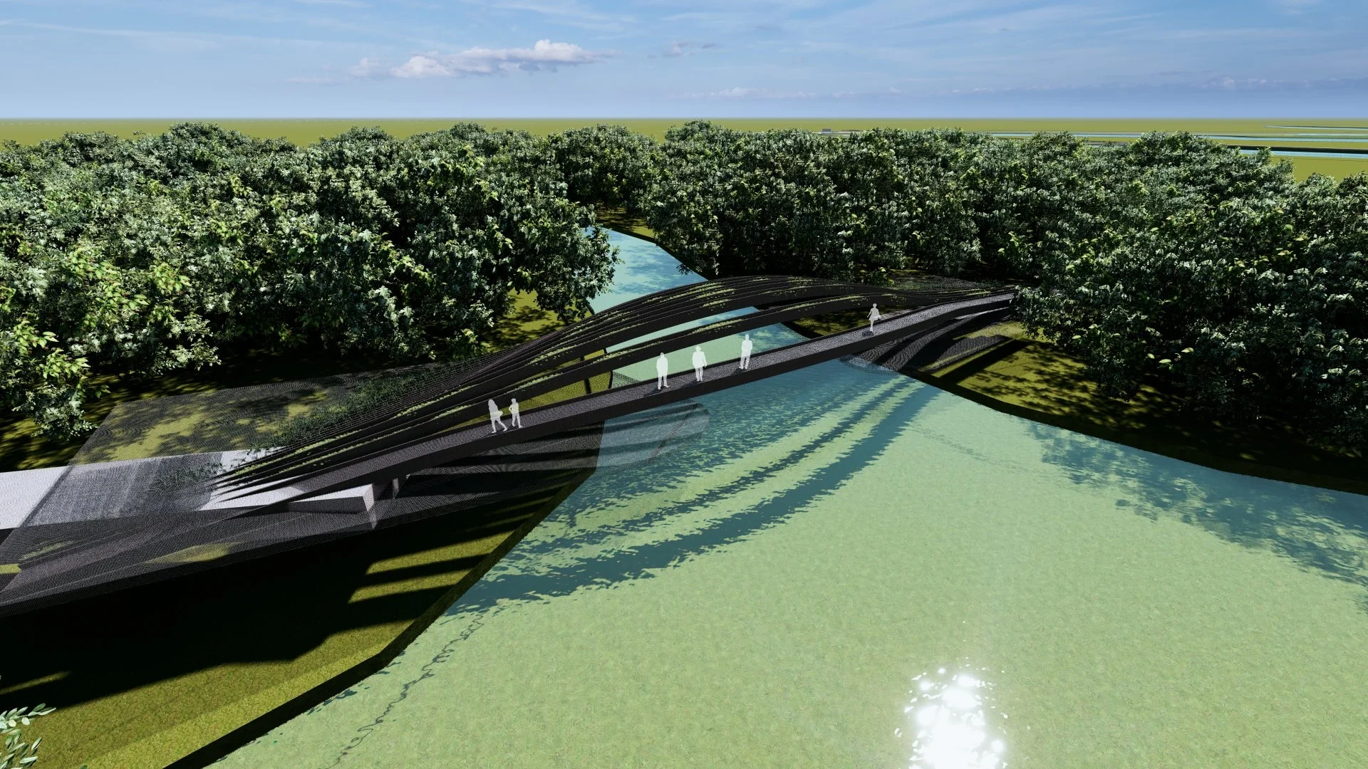
PROJECT GALLERY
-
Architect : Urbanscape Consultants Sdn Bhd
Client : Jabatan Landskap Negara
Area : 3,532,750,000 m²
Project Location : Keningau | Sabah
Year : 2025 -
Consultants : PERANCANG BANDAR Dr Adrian Chong Sui Chiang | PAKAR ALAM SEKITAR & HIDROLOGI Dr. Alexander K.Sayok | PAKAR GIS / PERHUTANAN Gs. Harem Anak Peri | PAKAR HORTIKULTUR Chong Kok Hwa
Photography : Urbanscape Consultants Sdn Bhd
Share this project